MAP ROOM
This page provides period battle maps that have been retouched, resized, cleaned up, and made available in pdfs that can be downloaded, printed, and assembled for gaming. Keep in mind that (as I mention below) these maps are intended for half scale gaming (either Bloody Big Battles or Kriegpsiel), so a map dimension of 26" x 23" would represent an actual gaming area of 52" x 46" at full scale.This page is divided into three major areas. In each area, there are tutorials, which are denoted by being [ALL CAPS AND IN BRACKETS]. PDF Downloads are indicated and [are bold in brackets].
A) General Tips
B) Historical Battle Maps
C) Modular Terrain and Battle Maps
As usual, clicking on an image will bring up a larger version.
---------------------------------------------------------------
A. GENERAL TIPS
B. HISTORICAL BATTLE MAPS
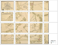
These are period battle maps that have had the graphics erased, touched up, and resized to roughly to 1/2 Bloody Big Battles scale (which is also roughly half scale for Kriegspiel)--so the target scale for these is about 1:15,000. I took the estimated scales in the sources (where available) and used them to resize the maps to playing size--and then did an eyeball test to tweak them a bit more (some more than others). So they aren't exact, but they're close enough--and certainly as close as many of the period maps from the era from which they derive.
An example of the process (using a map of the Battle of Kolin):
Map Selection: to begin with, I used maps from the UK Royal Collection Trust King George III's Military Map Collection. Although each is of a specific battle, I didn't pick them on that basis. I picked them for their suitability as gaming maps in general--although you could of course game the subject battles on them. Okay, I did pick one (Fontenoy) based on the battle (truth in lending), although that map might be used to represent some other battle, too, I guess. Given the source, these maps are from the Seven Years War, War of the Austrian Succession, and War of the Spanish Succession. They have the look of their era (not surprising), and as such would be particularly suited for playing one of the Bloody Big Battle variants for the 18th Century timeframe.
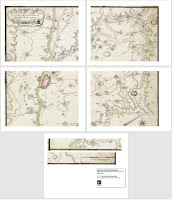
Each map has been put into a pdf. All that you need to do is download the file, print out the pages, and assemble them. To do so, I suggest that you review the [ASSEMBLING HISTORIC MAPS TUTORIAL].
Each battle maps below has thumbnails of the original version, the game version, and the print out. The "original" thumbnail is linked to the source map. The pdf download links are under their respective map thumbnails and are [bold and in brackets].
FONTENOY


I love what you're doing with these maps, Ed!
ReplyDeleteThanks, Chris. I'm looking forward to the next step: doing some gaming on one of these (I'm mulling over the various 18th century mods posted in the BBB group to get started).
DeleteExcellent resource, thank you!
ReplyDeleteExcellent resource, thank you!
ReplyDeleteQuite welcome, Doncaster :)
DeleteThis is fantastic work Ed. BBB and Kriegsspiel blocks make absolute sense and give a true impression of a large scale battle.
ReplyDeleteThanks, Dave. The system has been proofed in our club, and I've even taken it on the road and run it at a convention. So I can say at the very least that it does work. And it does have a certain visual appeal, even if not miniatures.
DeleteExcellent work here that produces a really atmospheric wargames terrain. The correct scaling and detail of landscape and terrain is something that I am very passionate about and I now do all my wargaming on period maps. I have to say that I do something similar in that I download the Ferraris maps of Belgium (dated 1770) from Wikipedia, resize them from 1: 11,300 to 1:7,500 or 1:5,000 of 1:2,000 and then print them out as A0 sheets (A4 4 x 4) which I can use to produce any size of wargames table. I add houses, towns, fortresses, woods as features and to increase the 3D effect for 2mm and 3mm troops. The Ferraris series covers several battlefield (inc Waterloo) but acts as general landscape for fictional games. Well done!
ReplyDeleteThanks for leaving a note and sharing your observations. I'm glad that what I've done meets with your approval (and passes the test!). I wasn't aware of the availability of the Ferraris maps: thanks for the tip!
DeleteThe question that I get asked the most is the maths of scaling any map to fit the space. Perhaps a little piece on that would encourage people. For me the parameters are set by the fact that I can print out an A0 sheet (4x4 A4 sheets) 1189 mm x 841mm. The printer will do this from A4 or A3 or A2 size, so we need to start with an A4 sheet 297mm x 210mm. So my procedure is to 1) measure the number of pixels on the scale of the map I am using, for example for my map of Jena 190 px = 4 miles. Convert to km, so 118 px = 1km. 2) Determine the size of my A0 sheet at the scale I want. eg 1: 7,500, or 1mm = 7,500 mm (or 7.5 m) eg. 1189 x 7,500 = 8.9 km 3) establish the size of this area on the map eg. 8.9 km x 118 px = 1050 px. 4) Cut up the map into boxes 1050 x 743 px 5) resize as A2 6) print out as 4x4 poster setting on printer. What you get is a correctly scaled A0 sheet.
DeleteAs you pointed out there is some adjustment to be made because when the printer prints out the sheets, it adds a border and this reduces the size of the print slightly. To compensate I subtract 10% so make it 1: 6,750 instead of 7,500. But its a printer issue so experiment with yours.
What's your method?
DeleteAs far as scale and size, I discuss those details in the "Guide For Half Scale BBB WIth Kriegspiel Blocks" pdf that can be found on the BBB Resources page (scroll down past the half scale terrain effects reference to find it). As far as producing and printing the maps, I use only the basic programs found with the PC operating system (MS Paint, MS Word). After cleaning up and configuring the map (per the steps on this page), I then open the map (a single jpeg sized per the scale) in MS Paint and open the print preview. I then set it to print on US letter sized pages at 100 percent (ie, full size), usually with a 1/2 inch border (or I resize the border to 1/4: it doesn't really matter). Then MS Paint will break the large jpeg into multiple page sized images. I then scroll through the print preview, one page at a time, and take a screenshot of each page. I then paste those screenshots into an MS word document (one per page at 100 percent). If there are some "strips" I might put those all on as single page (otherwise you will have to print one page for each). Then I save and print that document off and just cut out and assemble the sheets. For sharing, I save the word document as a pdf (and those are posted on this page). It's a low tech workaround, but it works for me.
DeleteI should add that if all you want is to print off the map, then you can skip capturing the pages and putting them into a word document--after reviewing the size of your overall image and then the individual pages in print preview, you just print them out. The only thing I do in that case is make a record of what settings I used for the page parameters in so that I can print another if needed. The advantage of taking the extra step to create a MS Word (or pdf) is that it is then stored ready to print without having to reconfigure it (and you can it is more shareable).
DeleteAnother good source for historic maps like the ones that you are using is https://www.davidrumsey.com/ search for "Alison" which is Alison's History of Europe which has over 100 maps of the Napoleonic Wars. They are free to download and the file sizes are large so that you can print off decent prints of them
ReplyDeleteThanks, I'll check it out!
DeleteHave written a blog post with my methodology for rescaling downloaded maps from sites such as the Ferraris and Rumsey ones and have referenced your blog for the printing part of the technique. See https://www.hgwdavie.com/age-of-battles/2025/5/17/creating-table-top-terrain-from-maps. Am still hunting down suitable maps for ACW and other C19th battles.
ReplyDeleteThanks for the mention--it's clear that I have much to glean from your work!
DeleteHi! These are some amazing maps! Though im wondering if it'd be possible to get some maps that have a Company scale battle in mind? Im doing something akin to Kriegsspiel but with more units that can't be portrayed in a battalion scaled units, thank you mate!
ReplyDeleteI'll get the maps printed after our Christmas break at our highschool printer✌️
Thanks for the note: I appreciate knowing when someone stops bye. The first thing I would suggest is putting together a modular map to suit your scale (see the modular map tutorial and modular map terrain sets). If you want to use one of the historical maps, then maybe you could choose a particular area or sector of one of them, copy it (using a screen capture app), and then make it bigger to suit your scale.
DeleteI forgot that I had provided the actual jpegs of the maps. If you want a different scale/size, then you could just grab the image of the map you're after (under the "base historical map files") and then resize it to suit (no need for a screen capture).
Delete